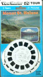
1. Pre-emption View of Spirit Lake and Mt. St. Helens (9677 Ft.)
2. Spirit Lake and Mt. St. Helens (8365 Ft.) as They Appear Today
3. Air View—Looking into Crater and Lava Dome
4. Silver Lake Visitor Center
5. Mt. St. Helens View from Silver Lake Visitor Center
6. Mt. St. Helens and Toutle River from Hoffstadt Bluffs
7. Hoffstadt Canyon Bridge Crosses Boundary of Blast Zone
View-Master Reel B
1. Telephoto View of Mt. St. Helens
2. North Fork Toutle River—Path of Mud from Eruption
3. Eagle Rock Viewpoint Shows Blast Zone and Path of Mud Flow
4. Low Profile Coldwater Visitor Center Overlooks Crater and Blast Zone
5. Interactive Exhibit Stresses Protection of Surviving Plants
6. "Winds of Change" Interactive Trail Tells Posteruption
Story
7. Coldwater Lake—6 Miles Long, 200 Ft. Deep—Formed by
Eruption
View-Master Reel C
1. Mt. St. Helens from Bear Mountain Viewpoint
2. Blown Down Trees in Blast Zone (150 Square Miles)
3. Blast Aftermath—Abandoned Miner's Car, Meta Lake
4. New Growth Amidst Devastation of Blast Area
5. Fallen Logs Nearly Fill Spirit Lake
6. Mt. St. Helens from Highway 99 Viewpoint
7. Rangers Give Interpretive Talks at Windy Ridge